 Gaia GPS: Offroad Hiking Maps

Hiking, biking, camping, walking, offroading offline maps for outdoor explorers
続きを読みます
Hiking, biking, camping, walking, offroading offline maps for outdoor explorers
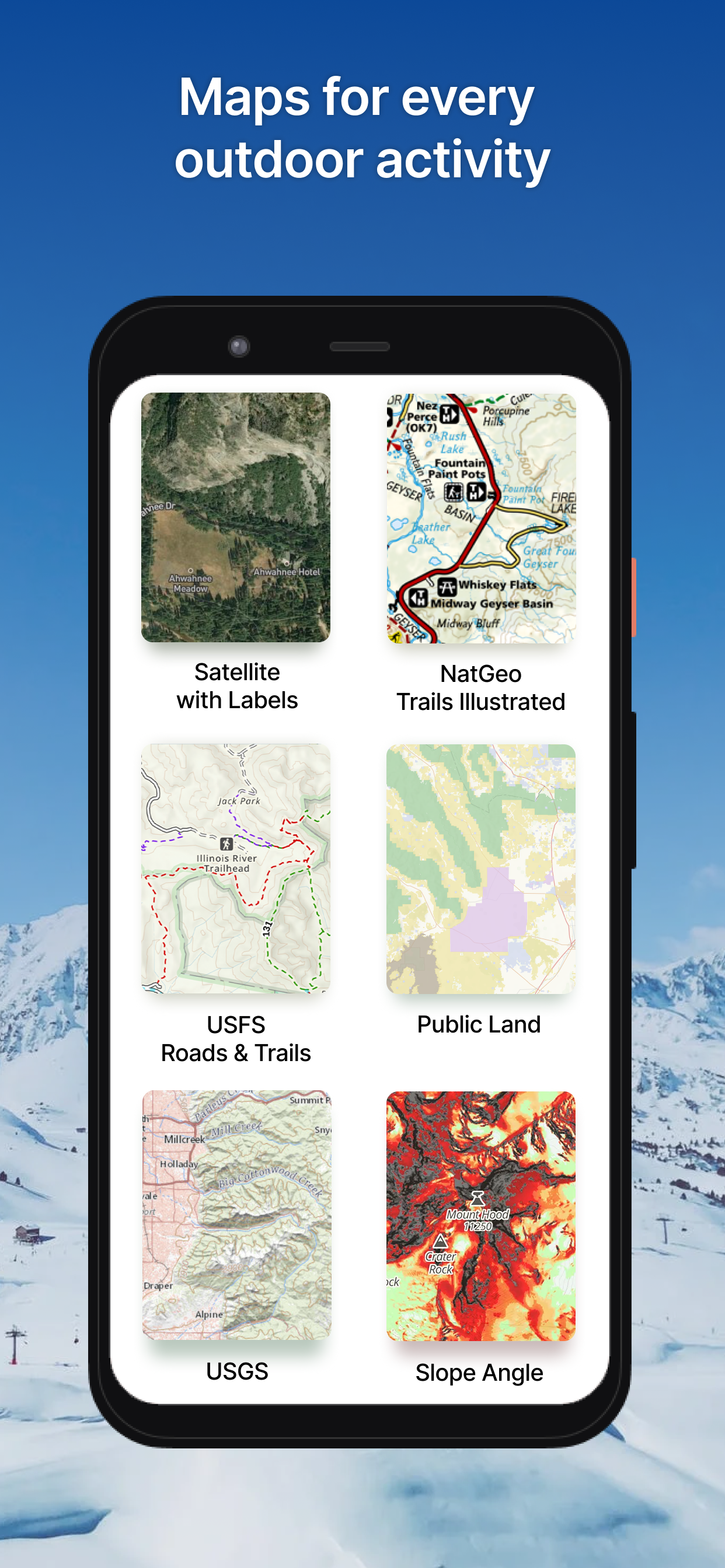
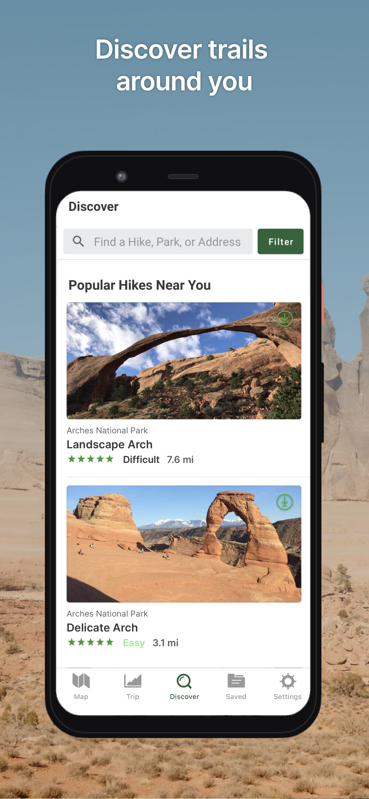
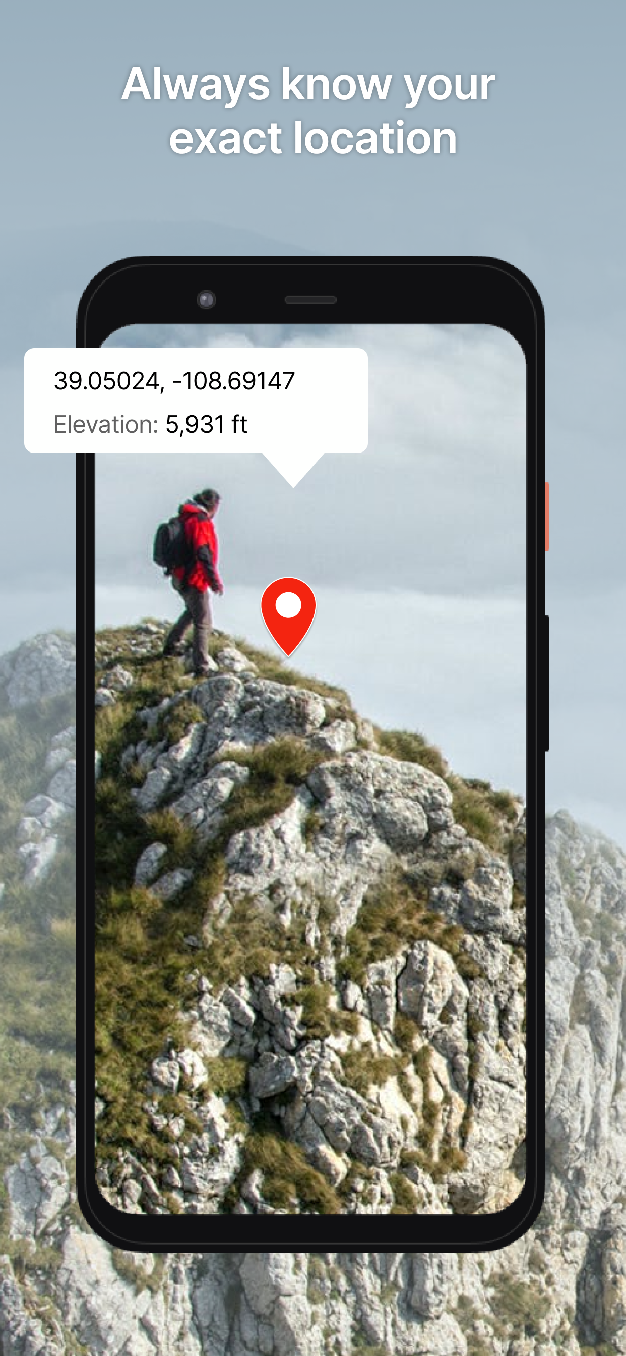
Join the millions of people worldwide who use Gaia GPS to backpack, hike, find campsites & explore trails and backroads all over the world. Gaia GPS is the best map and navigation app for backpacking, hiking, offroading, and all outdoor lovers alike. Featured in countless publications like the New York Times, Washington Post, and GearJunkie, Gaia GPS provides the best offline maps and navigation tools for your adventures.HIKING, BACKPACKING, TRAIL RUNNING• Discover trails and plan your own routes with Gaia Topo, the world’s most powerful backcountry map.• Or choose from hundreds of other maps, including Nat Geo Trails Illustrated, USFS, and hi-res satellite imagery.• Take your maps offline so you always know where you are, even far from cell service. • Leave a breadcrumb trail on the map so you can always find your way back.• Use intelligent routing tools to create routes on the fly.• Measure distance, altitude, and elevation change.• Mark campsites and points of interest, drop photo waypoints.• Weather: get current radar and forecasts to stay on top of changing conditions.CAMPING• Discover and reserve campsites right from the map.• Find dispersed camping far from the crowds with public and private land boundaries and USFS maps.• Mark campsites with waypoints so you can easily find them late at night or on your next trip.OVERLANDING• The premier offroad app for planning, navigating, and recording 4x4 and overlanding adventures.• Take topo maps, USGS, USFS, MVUM, public and private land maps offline so you can always find your way, even without cell service.• Plan expeditions on your desktop at home with intelligent route planning tools. Reroute on the fly using your phone or tablet in the field thanks to snap-to-trail route building. Drop customizable waypoints to mark campsites and points of interest.• Stay one step ahead with precipitation forecasts and wildfire activity.Display your maps, routes, and waypoints on your dashboard with Apple CarPlay and Android Auto integration. BACKCOUNTRY SKIING• Identify avalanche terrain with slope angle shading and get the avalanche forecast.• View incoming weather and get SNOTEL data.• Track your location, even without cell service.MOUNTAIN BIKING• Find the best trails curated by the team over at Trailforks.• View trail difficulty, direction, and conditions.PROFESSIONAL USE• Gaia GPS is the preferred nav app for outdoor professionals.• Quickly route to GPS coordinates, view recent wildfires, and share maps, tracks, & waypoints with your team.• Mark routes, campsites, & water sources.• Share data with clients & fellow guides.MEMBERSHIP• Free – limited maps, for online use only. • Premium – full online and offline access to the map catalog; print custom maps.SIGNUP• Gaia GPS is part of the Outside Inc, family. You must create an Outside account to access the map. TO MANAGE YOUR SUBSCRIPTION:• TURN OFF auto-renewal: https://support.google.com/googleplay/answer/7018481• Subscriptions automatically renew unless auto-renew is turned off at least 24 hours before the end of the current period. Your Google Play account will be charged for renewal within 24 hours of the end of the current period & identify the cost of the renewal• Your Google Play Account will be charged at confirmation of purchase.• Privacy Policy: http://www.gaiagps.com/gaiacloud-terms/• Terms of use: http://www.gaiagps.com/terms_of_useNew- Route planning tools to reverse, route back to start, create an out and back, and undo any of your changes- Change the color of any waypoint- Updated map layers and downloads menu- Scrub elevation profiles to show you exactly where that steep section isFixed- Crash when editing a route offline- Map labels rendering below tracks or guidance lines- Better prompting for navigating via bearing and distance or turn-by-turn guidance